Tassie Roadtrip – Northeast to Ansons Bay January 2023
Travel companions: two enthusiastic travellers from the West
With Mt Barrow looming, we left Myrtle Bank in the Northeast of Tasmania/lutruwita for the East Coast – Tasmania’s Bay of Fires. A convoy of two. Three adventurous women from Western Australia!


Ansons Bay, remote paradise (as the entrance sign declares) is on the Northeast coast of Tasmania. The Bay of Fires, situated on the land of the Palawa people, was described as such by the early explorers when they arrived on Tasmania’s shores to see fires burning. The eye-catching orange lichen that covers the coastal rocks in this part of the world contrasts directly with the wild blue seas and green coastal scrub.
Eddystone Point Lighthouse/lutruwita is the closest sentinel that keeps ships from the treacherous rocks of the area. The lighthouse is just inside Mt. William National Park and is accessible by a gravel road.


Our first stop was Scottsdale – around 40 kilometres from Myrtle Bank. Scottsdale is the small town where I went to high school, spent weekends with my best mate, and got up to all sorts of mischief—being an “out of towner,” I more often than not spent entire weekends in Scottsdale.
A stop in Scottsdale always entails a curly pasty at the Scottsdale Bakery, a browse in the op shops, and shopping for stores at Woollies. So, our op shop haul packed in the back, ice in the esky, food shopping done, and wine and beer purchased, we set off towards Derby, the mountain bike capital of Tasmania.


Derby was an ex-tin mining town with no future and cheap real estate before it became the darling of the Mountain Bike scene. Tasmania now boasts world-class mountain bike tracks, and people come from all over the world to travel the trails. It was here we used to go in the 80s to watch or compete in the Derby River derby – homemade craft set sail in the freezing waters over a weekend where Derby came to life for a moment only to go back into hibernation for the remaining 360 days of the year.
We stopped here for firewood and to call the Tasmanian Fire Department to get permission to light a fire on the block. The town of Derby was buzzing with bikes and people. A block in Derby that could be bought for next to nothing a decade or more ago now sells for six figures.
Gladstone, the last petrol station/shop/hotel before Ansons, was advertising a music festival that looked like it was heavy metal inclined for the coming Saturday night. A mutual agreement to bypass this particular musical offering was made without any discussion required.
The drive from Gladstone to Ansons Bay is via a gravel road and passes through some lush farming country where fresh-cut hay assaults the senses. The occasional copse of bush punctuates the trip. We had our eyes peeled for wombats and echidnas and were sad to observe roadkill that included wombats and Tasmanian Devils.


After around 30 minutes, we crested the hill and entered Ansons Bay. The view of the inlet and ocean beyond always takes my breath away. The inlet on this day was dark blue, and the ocean aqua – remote paradise indeed!
My block is a bush block sitting on the hill overlooking the bay, a mere 100 metres from the bay. Once the gate had been wrestled with, and we had given the caravan and shed annex a quick once over with the broom, we unpacked food, clothing, knitting, notebooks, novels, cameras, and games.


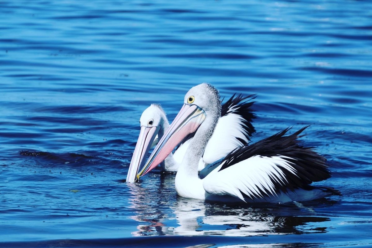
The beds could wait; it was time to go and check out the bay, where the local fishermen, pelicans, and dogs greeted us like long-lost friends. The water felt warm and was relatively clear, and the locals were curious.


“Where you from?”It seems everyone has a link to Western Australia, knows someone, or has lived there at some stage.
Our stroll took us past shacks and caravans of varying sizes – little, it seemed, had changed since my visit eight months earlier. Ansons Bay is like the holiday destination that time forgot. Electricity is available, but some properties, including mine, are not hooked to the grid. There is no petrol station, no shop and very little mobile coverage. The telephone tower was placed tantalisingly close but not close enough.
The locals have signposted an area just before you head down the hill into the town named “connection cove,” where you can pull in to answer emails and messages and update your socials. So close yet so far, and dare I say it – One Job!
We were feeling a bit warm, so we decided a swim was in order, and the nearby Policeman’s point was beckoning. The road out to Policeman’s Point is gravel and takes you to the inlet, where the brackish waters of the bay meet the pounding waves of the Tasman Sea. The tide was on its way out when we arrived at the popular camping site, exposing the vast sand flats, a popular fishing spot for campers and locals alike.
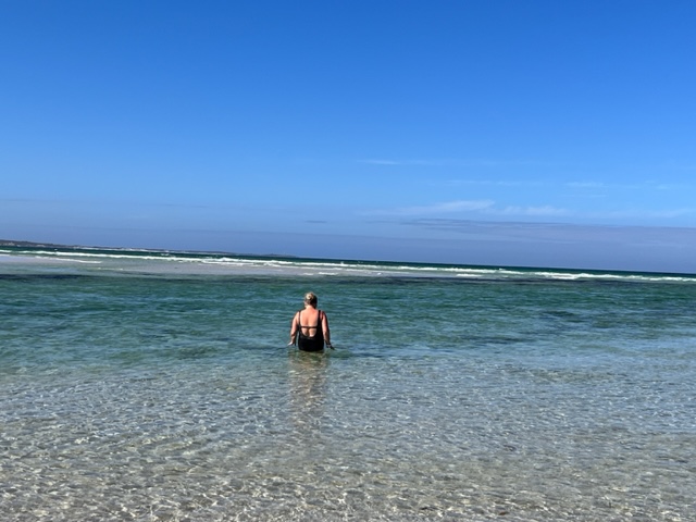


We immersed ourselves in the clear blue water, dodging blue bottles and rushing seaweed. The water was deliciously cooling without being too cold. It massaged our skin and washed away a week of business and travel. All that fresh air and salt water excited our senses, and suddenly all we could think of was nibbles and drinks. So we started back for camp only to discover Elaine had lost her phone. A trip back to the beach and the phone was right where she had dropped it!
The sun was still beating down at 5:00 pm, so we found some shade and set ourselves up with beers in hand and a tray full of delicious morsels. Never had anything tasted so good.
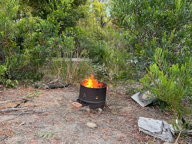
Even though it is nowhere near cool enough for a fire, we thought we should light one as we had permission to do so. The fire crackled at a distance, and our senses were loaded with everything that is good and fine in a remote paradise.
A day to remember and one of many to come.
What’s the skinny?
- Ansons Bay is situated on the “remote beaches” region of Tasmania in the North East.
- If travelling from Launceston allow a good two hours and a couple of stops – 165 km.
- One of those stops has to be the Scottsdale Bakery for curly pasties and scones. Supermarket shopping can also be done here.
- Derby (Mountain bike capital of Tassie) is worth a stop to soak up the mountain biking vibe. The Blue Derby Mountain Bike Trail is world class.
- Gladstone is the last petrol/booze stop before Ansons Bay where this are no shops and the Gladstone Hotel does a super counter meal.
- Camping is only available in the designated camping area of Policeman’s Point (15 minutes drive from Ansons Bay) or further towards St Helens.
- Check with the Fire Department before lighting fires.
- Mt William National Park is accessible from Ansons Bay.
- When driving at night slow down so as not to run over any wildlife.
- Mobile coverage is sketchy – download any maps you might need.
- You can use the telephone box situated next to the fire station to make free calls within Australia.