The Sixty Foot Falls walk trail in the Perth hills

Sunday morning started out at around 22 degrees with a lovely fresh breeze and some sunshine with a promised high of 27 degrees on the horizon. Perfect morning for a hike!

Perth City is only around 45 minutes drive to Darling Scarp or as the locals call it, “the hills” area , and we picked out a trail we hadn’t walked before At Banyowla Regional Park in Gosnells.

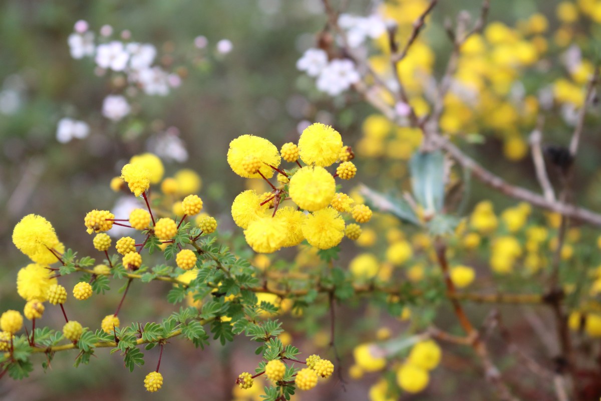
Banyowla (pronounced ban-yow-la) recognises Banyowla a Nyoongar elder at the time of colonial settlement. The park has 550 species of flowering plants, 116 species of birds, 9 species of frogs and 8 species of native animals. The Ellis Brook flows seasonally from June to October, depending on rainfall.

There are 4 marked trails varying in difficulty and length beginning with the Easy Walk Trail, a 500m loop, the Eagle View Trail (moderate) a 430m return. The blue Wren Ramblue was listed as being easy and 2.8km return. The Sixty Foot Falls Trail (difficult) 2km loop with elevation.

The marker for the Sixty Foot Falls Walk

The walk we decided on, the Sixty Foot Falls Walk Trail took to us an elevation of around 150m and promised waterfalls and great views of the city. Waterfalls were definitely not expected as it is the middle of summer but views on a clear day are always a yes from me!

The place where the falls would be falling in the right season.

When we arrived at the gate we had to park on the road as the gate to the park was not open despite there being a sign stating that the gate was open between 6.00 am And 7.00 pm. No problem, it was only a short 1 – 2 km walk up the road to the beginning of our trek.

The walks were very clearly marked and maps were on display in various locations. We chose the “Sixty Foot Falls Walk Trail” which was around a 2km Loop that took in the water fall and the old quarry site.

After a quick look at the map we cleaned our shoes at the dieback station and started following the clearly marked arrows that took us up to the first lookout area.

The dieback shoe cleaning station

The path was pretty rocky in places and had steps cut out to enable easy climbing.

While climbing up we could see where the waterfall would usually be flowing and the view from the top was incredible. The city and surrounding suburbs clearly visible as it was a clear day.

Once we got over the top of the waterfall area we came across the old quarry with views from the top. This area is fenced so it is difficult to get too close, however, we could see that there was a road or track that allowed access to the quarry from the bottom.

The quarry was full of water which looked very inviting, however, there were signs warning that swimming might not be safe due to meningococcal risks. The surrounding cliffs are quite beautiful.

A video of just what is at the bottom of the Old Barrington Quarry

The quarry site, previously known as the “Old Barrington Quarry” is quite awe inspiring with huge cliffs that have been carved out by years of quarrying for stone.

The walks are suitable for both families and serious hikers. We saw some rock climbers in the quarry so it must also be popular with the climbing community

Climbers preparing for the rock face

I thoroughly enjoyed our hike to another of Western Australia’s hidden spots. We will definitely be back to see the water falling and the wildflowers blooming!

Avon Valley Hikes: Paruna Wildlife Sanctuary and the Numbat Trail

So, quite some time back my 26 year old son said that he wanted to walk the Numbat Trail and I was keen as were a few others. So we finally settled on the 1st September at 11.00 am for our walk. I had emailed ahead to book and pay the $10 pp entry fee. Contact Paruna Wildlife Sanctuary

The beginning of the Trails; The Possum, The Quenda & The Numbat

The Paruna Sanctuary is situated in the Avon Valley around 1 hour east of Perth. It is a wildlife corridor that links the Walyunga and Avon Valley National Park’s, an area of around 1 912 hectares. The Australian Wildlife Conservancy operate the park where many species of wildlife live including the Western Quoll (Chuditch), the Black-Flanked Rock-Wallaby, Tamara Wallaby, Woolies, Quenda and Brushtail Possum.

The date approached and leading up to the Sunday we were due to walk the weather became increasingly nasty. On the Sunday morning the Bureau of Meteorology clearly stated that storms were expected and that the wettest time of the day would be the middle part. Both my son and I checked the radar and cheerfully said to one another that it didn’t look too bad up in the Avon Valley. We drove up to Paruna in torrential rain still chatting and hoping against hope that the rain would “rain itself out”.

Well lo and behold it stopped raining when we arrived and there was “enough blue sky to make a pair of sailor’s trousers” (a saying my grandmother was oft to use) and we enthusiastically exited our cars and put on our wet weather gear. We had already decided before we arrived that we would do the 12 km Numbat Trail. There being 3 options of varying lengths and difficulty. The Numbat being the most challenging.

The first part of our walk was punctuated by showers but nothing too wild. I was quite disappointed that the skies remained grey because being the photographer that I am it’s all about the light! The trail was well marked and maintained. We stopped periodically to look out from the various look-outs and to have a quick drink or snack.

The wildflowers didn’t disappoint and there was a healthy flow of water in the waterfalls and streams that we passed. We reached the point where the Numbat Trail takes a turn and leaves the main trail to begin the loop. One of our party decided that she would turn back and meet us at the beginning of the main trail and the rest of us soldiered on.

The loop was probably the most challenging part of the walk as it wound it’s way up to the highest point of our journey. The surrounding landscape was quite clear with many grazing areas. As we ascended the steep incline we saw mobs of grey kangaroos who stopped their grazing to gaze at us with curiosity and we also noticed that there was mobs of grey clouds approaching accompanied by howling wind. When we reached the very top we were hit by gale force winds and horizontal rain. There was nowhere to shelter so we crouched behind some shrubs.

Absolutely drenched, we decided that it was best to keep moving. I abandoned all hopes of taking amazing panoramic photos of the view and the surrounding bushland and jammed my camera into a plastic bag for the downhill descent.

The water was, by this time, flowing under our feet and some of us were beginning to feel that first squelch that meant that our shoes had finally given into saturation. None of this, however, took from the beauty of the surrounding bush and landscape. I only wish that there had been a break in the rain so we could stop and take in the beauty of the elevation.

When we got back to our fellow-walker , she too had tales of trying to huddle under the bushes and even attempting to get under the picnic table! The rest of the walk back was really wet but I did manage to pull my camera out for one attempt at photographing some drenched Yellow-Tailed Black Cockatoos.

The entire walk took us 4.5 hours and we were suitably exhausted and very very wet when we got back to our cars, by now the only cars in the carpark! The hot shower and glass of red wine was very welcome when I got home. I am definitely returning in the finer weather to do this walk again. Unfortunately the park closes at the end of September so I might not get there this year. Oh well, there is always next year.

If you would like to read about another hike close to Perth, click here https://www.lisabenjess.org/the-sixty-foot-falls-walk-trail-in-the-perth-hills/