SUPing Around

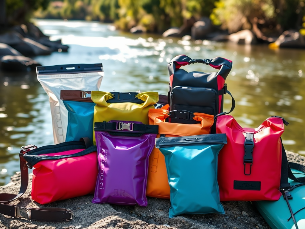
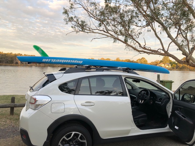
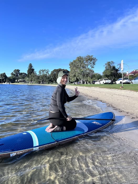
Welcome to my first newsletter.  You are here because you paddle or are paddle-curious. Or maybe you just thought SUP has something to do with food or drink? I will try to satisfy all comers. Perhaps there are recipes we can share 🙂

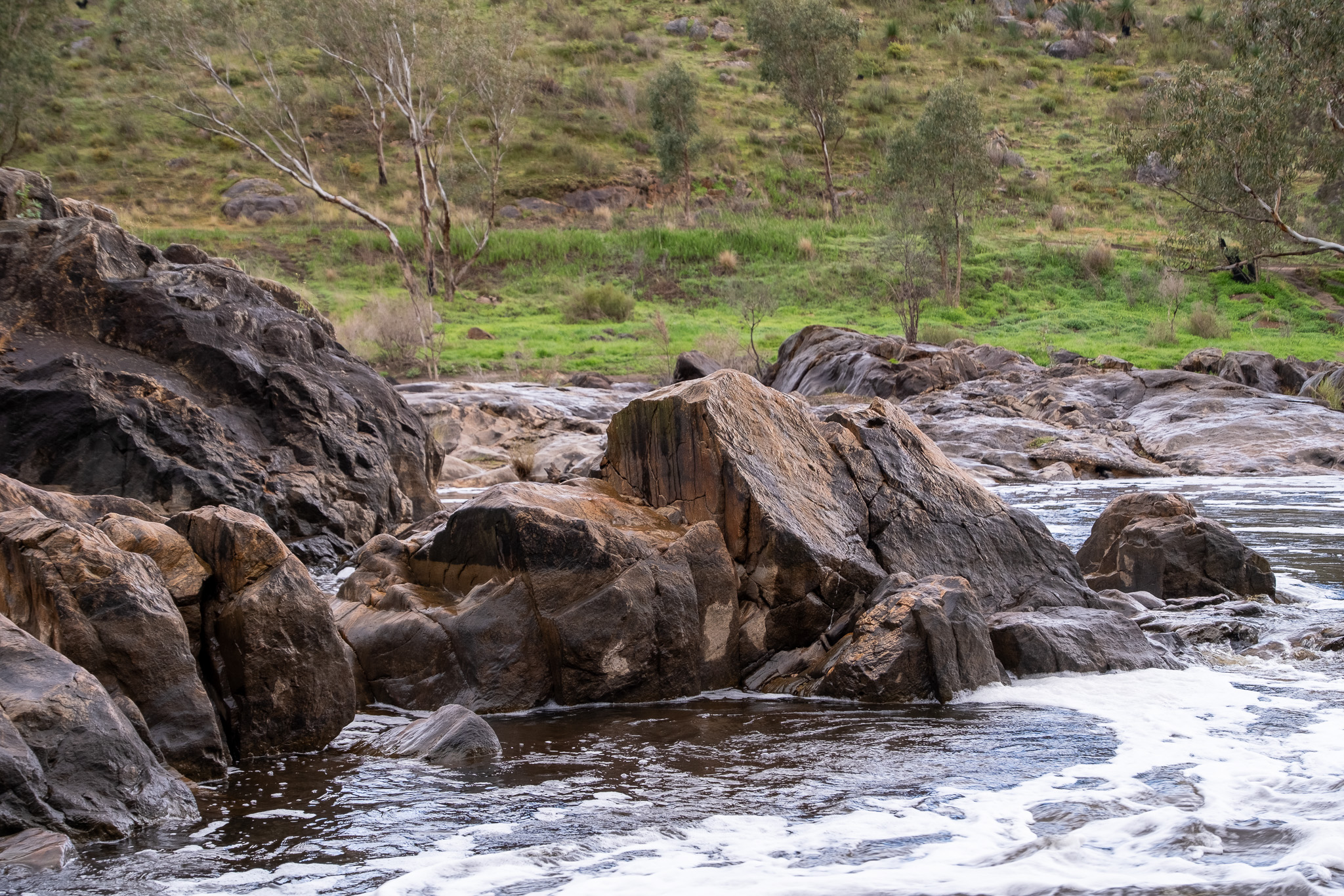
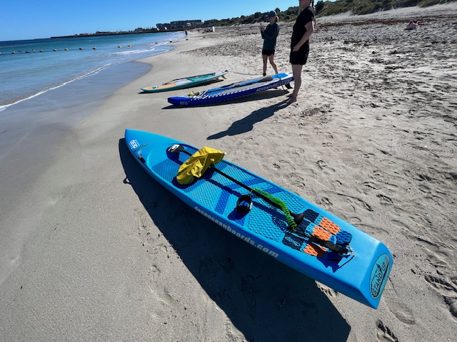
I recently did a round up of some of my favourite standup paddle locations around Perth so I thought I would start with those.  These are not the only places you can paddle in Western Australia; we are very lucky to have so many spots to splash, and I will continue to review and add places to paddle in future issues.

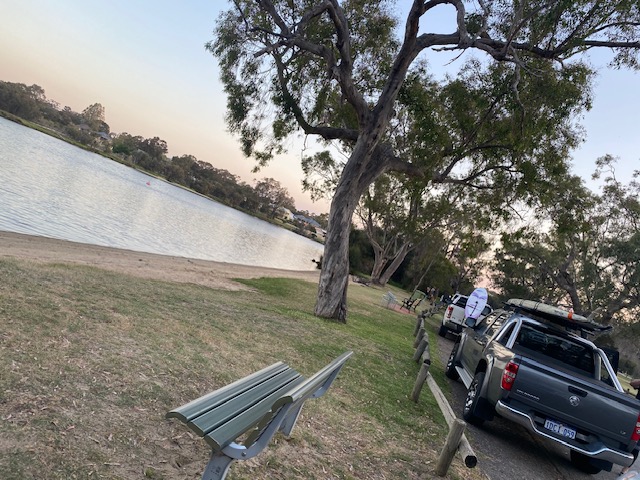
Claughton Reserve, Bayswater

Looking for a sheltered upriver paddle location. Claughton Reserve in Katanning Street, Bayswater is one of my favourite SUP launch spots. 

💦there’s heaps of parking

💦a toilet block (in fact one of the funkiest toilet blocks I have ever seen!)

💦water fountains for filling your water bottle

💦easy to get in and out of the water

💦coffee stop at Ascot Kayak Club on weekends

It’s a great place to explore up or down the river depending on the winds.  A nice short paddle from there is up river and around Ron Courtney Island.

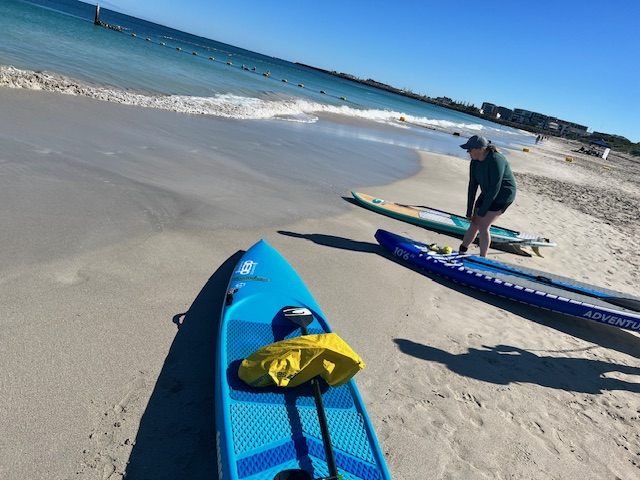
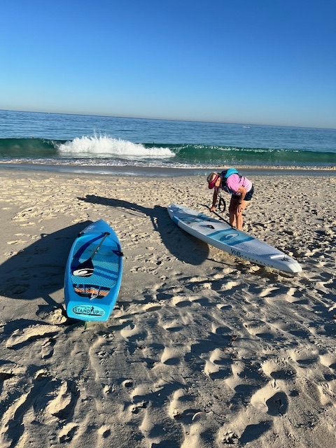
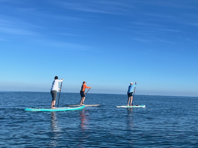
Ocean Paddling Perth

Perth’s southern beaches; Leighton, South Beach & Coogee Beach are wonderful when the conditions are right.  It’s knowing when the conditions are right that is the tricky part.

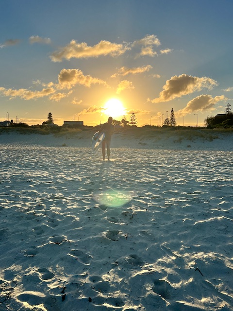
As with most outdoor activities in Perth I always go out in the mornings – the earlier the better.

In the Summer months from November to March the morning winds are more likely to be offshore (Easterly) and light.  Once the Freo Doctor comes in it’s too late and too windy. 

Use weather apps such as:

Willy Weather

Seabreeze

BOM

Windy.com

Not only is getting up early to paddle good for getting the right or no winds, but also to avoid the hottest part of the day.

Perth’s southern beaches:

💦are easy to get to

💦have free parking – but can be busy the later you arrive (see, getting up early has other benefits!)

💦have great cafes

💦have showers and changerooms

💦you can sometimes see dolphins, whales & sealions

💦North Coogee has the Omeo Wreck – great for SUPing around but also a very popular snorkelling spot. Pack your gear!

Go with a group or a buddy if you are a first timer on the ocean, ALWAYS use a leg leash and don’t go out further than you are comfortable with.   Be prepared to get wet and HAVE FUN!

Point Walter Reserve Bicton

You can paddle down river from the Point Walter sandbar, up past the cliffs at Blackwall Reach. Depending on the wind it can be quite sheltered through there.

Keep paddling down to Bicton Baths  and turn around or alternatively (depending on wind) do the reverse.

Handy tip: always paddle into the wind on the way out so you get a free ride on your return. It makes a difference

💦parking is usually available closeby  and if it’s not you can drop and park.

💦there’s  a great cafe at Point Walter

💦the scenery is amazing along Blackwall Reach

💦dolphins also love this part of the river

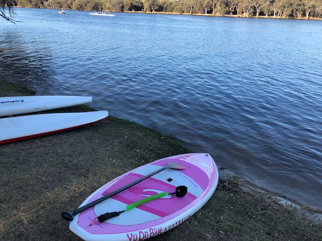
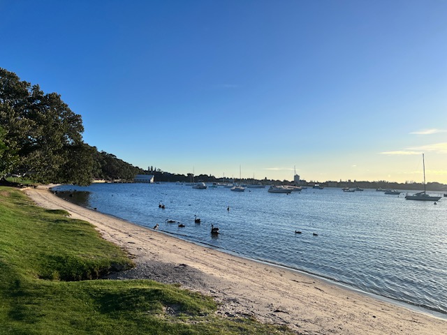
Freshwater Bay, Peppermint Grove

Freshwater Bay in Peppermint Grove is a beautiful spot to get out on the water. There’s usually sheltered waters close to the shore for those venturing out for the first time. Or for the more adventurous, a paddle along the cliff’s edge to the yacht club is a lovely paddle. Dolphins 🐬 are common in this area.

💦the water is clear

💦the shore easy to access

💦parking not usually a problem

💦 cafe close by for coffee and snacks

Some links to previous articles and websites of interest:

Interested in racing and SUP events including the SUP Loop check out Perth’s SUP body SUPWA https://supwa.tidyhq.com/

Next newsletter: Kent Street Weir, Maylands Breakfast Paddle, Heirisson Island, Matilda Bay

Choosing the Right Waterproof Bag: Tips and Reviews

Dry bags for wet situations! A look at ways to keep your stuff dry when on the water.

I have used all types of waterproof bags in my paddling life. As a rower, kayaker and SUPer I have worked my way through dry bags, phone cases and plastic bags. I’ve tried waist clips, shoulder clips, board clips and a string around my neck. I have more dry bags than handbags.

Of course it will always be up to personal choice and comfort so there is no perfect solution for everyone. The perfect solution is the one that works for you.

Dry Bags

The good old dry bag is a sure thing. It’s purpose built to keep your stuff dry, and provided you fold the top over correctly (at least 3 times) it will work. I use a dry bag to carry things on my board because I have straps that I can clip onto.

Who doesn’t love an Aldi bargain?

You can buy affordable dry bags anywhere. My faves are a set I got from ‘the aisle of dreams’ at Aldi. I also have bags from Sea to Summit which are more lightweight but just as effective. I have used the heavy-duty bags from Red Equipment – the 30L Waterproof Roll Top Dry Bag Backpack is great for using on your board or on your back.

Dry bags all the way when on the ocean!

Phone Cases & Bags

Since the dawn of the smart phone we have been seeking ways to protect them from getting wet, getting cracks, or getting lost!

Like everyone, I have purchased every new phone case known to woman. I had a great one that used to clip around my waist but the seal eventually gave up the ghost and I resorted to dry bags.

New Equipment

Which brings me to my latest piece of Red Equipment. I recently trialed on my SUP board and while out hiking, the Lightweight Waterproof Crossbody Bag 7L.

Disclaimer: I am an affiliate for Red Equipment but this doesn’t influence my opinions. While I believe in their products, my reviews are my opinions only.

This 7L bag is the ideal size for carrying your phone, keys and a piece of clothing. I carried my lightweight puffer jacket, phone, snack, keys and glasses on my latest hike. I used it as a crossbody bag for a while, before changing it to my waist. I found the waist placement much more comfortable and easier to access.

When I carried it on my SUP board last weekend I used it as a crossbody bag which was better than I thought. I had thought it would get in the way of the paddle but it was snug enough to keep out of the way. In future I will use it on my waist as that is my preference.

I persevered with using it in the crossbody style because that’s what it’s marketed as. It is better as a waist or shoulder bag in my opinion.

The bag does have a separate zip pocket inside for your phone and keys which would keep them dry, but I’m not convinced that your other gear would stay dry if fully immersed in water for any length of time. It has the roll down top used on dry bags which works better the more you put in the bag (if that makes sense).

I am an experienced paddler so falling in is not (usually) on the cards for me (if I chose not to) so I feel comfortable using this bag to protect my gear.

Were I to be out on the ocean or in a situation where falling in was a certainty, I would probably opt for a dry bag on my board or extra protection within the Red bag.

The bag itself is a nice looking bag and it comes in three different colours. It has an adjustable crossbody/waist/shoulder strap, and outside zip pocket, straps for bike handlebars and an external bungee system for extra items.

It is hardy and feels like it would survive almost anything I could throw at it or in it. This bag retails for $78.95 – if you use my link you get 15% discount.

So I guess it’s dry bags all the way for me on the water. They are good in most circumstances due to their reliability and cost. If ,like me, you love a good ‘fanny pack’ , ‘bum bag’ or whatever you call them, the RED Equipment Waterproof Crossbody bag is a pretty cool addition to your bag wardrobe.

Lighthouse Kid – Lisa Ikin

Living on the lighthouses was sort of like that TV show, ‘Round the Twist’ in more ways than you think!

Forty South Tasmania

When I finished my 3-day Three Capes Track hiking experience earlier this year I realised after pitching to many publications that I probably needed to tell this story in the land it was set. So the lovely people at Forty South Magazine, a magazine I have long admired and read, took me up on my offer of tourism travel blog with a side of memoir. Enjoy 🙂

I have scanned the magazine as best I could.

All in a Day #20 – Hiking Mt Cooke Darling Scarp WA

Mt Cooke Summit Hike WA – an out and back hike in winter to enjoy the Western Australian bush at it’s finest.

A Sunday morning in June, we woke before daylight to the intrusion of an ugent alarm. Setting off as dawn showed her sleepy face. The roads were quiet and mist lay low over the highway – parting as we approached. Currowongs littered the road side foraging for early morning roadside snacks – I have never seen so many before.

We needed maps to find the entrance to the hike off the Albany Highway about 50 minutes from Perth. No sign posts, just a sandy track through plantation pines and scrubland.

Cars in a row marked the beginning of the hike. A quick check of the AllTrails app confirmed we were indeed in the right spot. The sun peeked through the trees and I knew we were in for a treat!

The hike started gently with a narrow trail, damp with last night’s dew and covered in boot prints meandering through grass trees, jarrah and rocky outcrops. The climb to the ridge was steep and sometimes slippery. Rocks glistened in the morning sun with water and sodden moss – green and lush.

The bush in this part of the scarp seems to have suffered less from the recent drought than bushland in Kalamunda. Some sapling had died back in the understory but the mature plants appear unscathed.

The trail led across the ridge where 360 degree views of the forest and surrounding lands took our breaths away. When we reached the summit a low mist was still hanging over treetops – we felt like we in the clouds.

The summit to Mt Cooke, the highest point on the Darling Scarp, is marked by a pile of rocks. A skull shaped boulder greeted us as we turned the corner. 582 metres above sea level. We continued on for another 5oo metres finding a clearing for a rest and a drink.

Some of the biggest Xanthorrhoea grass trees I have ever seen, towered over us. Their trunks blackened by a recent fire. The river beds were dry aside from some small pools of shallow water from recent rain. Enough to keep wild life sated.

The sun warmed us as the clouds and mist lifted slowly revealing the lands and trees below. We really had chosen the perfect time of day and weather for this 2 hour hike. Fellow hikers were few and far between despite several cars at the base.

A short rest and some snacks at the top before we turned back the way we had come. The way down was a bit treachourous and slippery, but we reached the car quickly while enjoying the views all over again on the way down.

An extremely beautiful and moderate hike! I will definitely be back to travel further and to complete an overnight hike in the area in the future.

What’s the skinny?

The Mt Cooke Summit hike is a 80km drive from Perth on the Albany Highway

Mt Cooke is within the Monadnocks Conservation Park https://exploreparks.dbca.wa.gov.au/park/monadnocks-conservation-park

Make sure you carry water and first aid when hiking

The hike joins the Bibbulmun Track so there are options for overnight hikes to Mt Sullivan. Camp grounds on the other side of Mt Cooke.

Xanthorrhoea Grass Trees can live for hundreds of years

Dogs are not permitted on the Bibbulmun Track

Download maps before leaving as coverage is hit and miss

All in a Day #17 – Remote Paradise, is there any other?

Heaven is a remote paradise. Ansons Bay is two hours drive from one remote mountain paradise, Myrtle Bank in northeast Tasmania, to the ocean and the Bay of Fires.

Note: I have written about this trip before with more details and links. A link to my previous trip is at the end of this piece.

The Drive

Forest flashes past with green speed. Man ferns (person ferns?) tower over shrubs and shade rocky outcrops from the dappled sun. Moss underfoot (were I walking) so spongey and vital, green and alive. Gradually the landscape changes to become coastal plains. Dust flicks from the wheels of the speeding car and sea mist coats the distant outline of coastal hills, a blanket, slightly damp and salty.

Day One

The breeze plays gently with this morning’s swimwear pegged at a jaunty angle on the green plastic clothesline cord. Op shop pegs. The bathers brush provocatively against the towel as rain threatens our previously sunny disposition.

Pending rain and it looks like it will be a laydown on last night’s sandy sheets for a nap, drifting off to the sound of pitter patter on the roof. The birds rejoice. Sandy feet and skin soft from salt water immersion in the sandy shallows at Policeman’s Point followed by a cool rainwater rinse.

Dad washes the dishes outside on the tank stand before the rain sets in “we won’t have to rinse these!” he says. A car passes on the road with mountainbikes atop ready for action in Australia’s mountain bike capital – the formerly sleepy town of Derby. He pauses his washing and looks up, a single word escaping his lips, “Derby” and returns to his dishes oblivious to other sounds with his earbuds in.

Day Two

Evening drinks in the Caravan seated on unmade beds with sandy feet. A spur of the moment walk down to the shore for exercise and “to blow out the cobwebs”. Children play along the shore, taunting one another with names and actions. They freeze as we approach and say “Hi” selfconsciously.

The sand is soft and the weed underfoot squelches through toes. We leave the shore and walk along the road past houses bunkering down for the evening. Smoke escapes some chimneys despite the warmth of this summer night. A border collie strains on its chain and barks a warning, or is it an invititaion?

A bit further on a tall Bennett’s Wallaby speeds across the road in front of us. We freeze and watch her bounding retreat.

Day Three

A trip to St Helens for supplies, op shopping and fish and chips. It’s a tradition and a necessity. We get to town in time for date scones and coffee at our favourite cafe, then it’s meandering from op shop to tip shop, to op shop again. We fill the back of the car with our treasures – clothes, bric a brac, books and jewellery.

By lunch time we are ready for fish and chips on the wharf. Families wait on the jetty while the delicious smell of fresh fish wafts across the water. Young children with fishing lines cast hopefully into the bay.

Back to Ansons Bay for a siesta and plans for mussell foraging in the shallows, later that evening.

Day Four

It’s all sunshine and blue sky on the bay. A great day for a paddle? Feelers have already been put out for a kayak to borrow, but no reply, so a trip to the beach it is. We always stop and chat to the cows.

A final swim at Policeman’s Point where the tide is out. The blues astonish with their depth of field, water of varying depths and colours. The tide is receding fast – there is only time for a quick dip and out. We finish with a walk along the beach before going back to pack up camp to head for home.

Fold up beds, clear out perishables, leave no crumbs for the ants, turn off the gas, the water and lock all the doors. Packing is frantic and some get left behind. But is there another way?

On our way home we stop to check out the Little Blue Lake just out of Gladstone. Astounding colours that could only be created by a disruption to the environment – an old mining site.

The trip back to Myrtle Bank is the reverse with a stop in to Scottsdale for pies and pasties, sneaky lamingtons washed down with Farmer’s Union Coffee on sidewalk tables. A chat with some locals – lean in for some town gossip, familiar and warm.

Groceries purchased, and a final browse of the local op shops, we pass the remainder of the trip uneventfully. Happy to get back to showers and comfy chairs. Back to mountain paradise! Check out another trip to this part of the world here.

Welcome to All In A Day

Early in 2023 I decided to focus my writing more towards travel and adventure. Travel writing is my passion – it doesn’t even feel like a job!

I also pledged to write an All In A Day piece every couple of weeks – Short adventures and musings that may or may not involve travel. I have loved this challenge and will continue for the forseeable future. Some of these experiences have become paid gigs that have been, or are about to be published in print or online.

While web content and copywriting (sometimes) pays the bills, and I enjoy the lifestyle freelance copywriting has allowed me to have, it doesn’t bring me the same joy of a well-worded travel piece or blog .

With changing economic times and AI thrown into the mix those web content and copywriting gigs have become more scarce. When businesses realise they can’t trust their business brand to AI there may be a turn around. But, until then travel writing has my back.

I hope you enjoy my blog. Unfortunately (or fortunately) if you spend time in my company you may also end up in my stories. I will always do my best to represent you in the shiniest way possible 🙂

What’s the skinny?

  • I will provide links and hints at the end of each blog.
  • The links I have provided are not sponsored, nor am I affiliated with any of the businesses I speak of (unless I say I am)
  • If you want me to write something for you, hit me up – this is my Lisa Ikin Writer hat.
  • I can write anything – web content, social media, blogs, emails…
  • Thanks for reading – you can subscribe and make comments 🙂

Hiking and Biking Taroko Gorge – Taiwan

In November 2016, my partner and I traveled to Taiwan. One of the reasons we decided on Taiwan, apart from the fact that neither of us had been before, was because we had read an amazing account of a hiking and mountain bike adventure in Taroko Gorge.

Taroko Gorge is in the Taroko National Park on the east coast of Taiwan. The mountains are incredible, spoiled only by a massive concrete factory at the foot of the mountains. The limestone and marble is quarried for concrete and jade.

Before we traveled to Taiwan we had researched and planned to stay at Taroko Lodge, a home stay set at the foot of the Taroko mountain range.  This modest accommodation is run by Rihang and his family.  Rihang purchased National Park passes for us and assured us that he would be at the train station to pick us up when we arrived.

https://rihang.wordpress.com/

Taroko Lodge Homestay

True to his word, a white van was waiting at Xincheng station, and we were greeted warmly by Rihang.  Rihang spoke some English and his son, who we met later, also spoke quite good English. 

We stopped at the 7-Eleven for supplies and then settled ourselves into our accommodation. Taroko Lodge is the front part of the family home. The sleeping arrangements were very comfortable, with our own bathroom, and a shared living area. 

The only other guests at the time were a group of Americans who were leaving the same day as us. We had access to bikes the whole time so we could cycle into the town for snacks or meals.

The first morning, following a delicious home-cooked breakfast on the veranda, we were piled into Rihang’s  van with our bikes and transported to the top of the Taroko Gorge access road.  Rihang let us out with a few words of warning about the tunnels we had passed through on the way up.

We strapped on our helmets and waved goodbye to our host with some trepidation.  We had a brief discussion about the tunnels which were numerous and completely dark and the fact that we had no lights on our bikes!  Too late now, we were at the top and the only way was down.

Luckily there didn’t appear to be a lot of traffic on the roads, that was until we saw the stream of tourist buses making their way up the winding road.  Tourist buses that I wouldn’t like to meet in a pitch-black tunnel with no light!  We watched them approach and started our descent.  Once the last tourist bus had reached the top and the crowd of local and Chinese tourists had disembarked for their obligatory selfies and group shots, we decided it was time to go.

The initial part of the descent was fine.  We stopped along the way to take photos and to take in the incredible views. Our first tunnel was one of the shorter ones and there was light at the end so it was easy to navigate.  “We’ve got this!” we thought. 

The next tunnel was one of the super long ones, no light at the end of this one.  There came a point where we were literally plunged into pitch black. Fumbling for phone torches while avoiding potholes.  A huge sigh of relief when we reached the other end and had not been taken out by a tourist bus or fallen off.  We lost count of the tunnels and needless to say we got to the end without further incident.   Rihang’s white van was a welcome sight!

Gauging from the loose health and safety precautions of the previous day, we prepared for our upcoming hike on the Zhuilu Trail with some caution.  The region had experienced an earthquake in the months leading up to our visit and we were informed that parts of the trail were unstable.  The ranger let us onto the trail through a locked gate and checked our permits.  Apparently, they only allow a limited number of people on the trail per day.  The signs warn of not attempting the climb if you have a fear of heights or a heart condition.  Venomous snakes and falling rocks are also something to look out for.  None of this deterred us but we proceeded with caution, nonetheless.

A suspension bridge that spans the entire gorge is at the beginning of the trail.  We were two of maybe 5 other people hiking that day.  Breathtaking and exhilarating are the only words I can use to describe our adventure.  The trails were used by the indigenous inhabitants of this region for centuries before our arrival and later by Japanese forces in their bid to control the area. Towards the top of the climb the trail becomes  a  very narrow ledge of around 1m in width and there was nothing but a steel cable to hold onto and a 700m drop.  There was only one-way traffic on this stretch of the path.

We had a clear day, so the view was phenomenal.  Such experiences do not come along very often. If the thought of the Zhuilu Trail is enough to give you vertigo, there are plenty of places to hike or take in the view without balancing on a ledge.

The beginning of the “ledge”

That night we had a lovely meal at a local restaurant with our fellow travellers from America.  It was the eve of the US election results in 2016 and they were certain that Trump would not be elected.  They left early the following morning before we knew what the result was.  I often think about them and how disappointed they must have been.

The final morning was spent exploring the small village and venturing onto the deserted, rocky beach.  Rihang took us back to the train station and we said farewell to our lovely host before heading back to Taipei.

If you haven’t read the full account of our trip to Taiwan. https://www.xyzasia.com/home/first-time-taiwan-hiking-biking-train-trips

Avon Valley Hikes: Paruna Wildlife Sanctuary and the Numbat Trail

So, quite some time back my 26 year old son said that he wanted to walk the Numbat Trail and I was keen as were a few others. So we finally settled on the 1st September at 11.00 am for our walk. I had emailed ahead to book and pay the $10 pp entry fee. Contact Paruna Wildlife Sanctuary

The beginning of the Trails; The Possum, The Quenda & The Numbat

The Paruna Sanctuary is situated in the Avon Valley around 1 hour east of Perth. It is a wildlife corridor that links the Walyunga and Avon Valley National Park’s, an area of around 1 912 hectares. The Australian Wildlife Conservancy operate the park where many species of wildlife live including the Western Quoll (Chuditch), the Black-Flanked Rock-Wallaby, Tamara Wallaby, Woolies, Quenda and Brushtail Possum.

The date approached and leading up to the Sunday we were due to walk the weather became increasingly nasty. On the Sunday morning the Bureau of Meteorology clearly stated that storms were expected and that the wettest time of the day would be the middle part. Both my son and I checked the radar and cheerfully said to one another that it didn’t look too bad up in the Avon Valley. We drove up to Paruna in torrential rain still chatting and hoping against hope that the rain would “rain itself out”.

Well lo and behold it stopped raining when we arrived and there was “enough blue sky to make a pair of sailor’s trousers” (a saying my grandmother was oft to use) and we enthusiastically exited our cars and put on our wet weather gear. We had already decided before we arrived that we would do the 12 km Numbat Trail. There being 3 options of varying lengths and difficulty. The Numbat being the most challenging.

The first part of our walk was punctuated by showers but nothing too wild. I was quite disappointed that the skies remained grey because being the photographer that I am it’s all about the light! The trail was well marked and maintained. We stopped periodically to look out from the various look-outs and to have a quick drink or snack.

The wildflowers didn’t disappoint and there was a healthy flow of water in the waterfalls and streams that we passed. We reached the point where the Numbat Trail takes a turn and leaves the main trail to begin the loop. One of our party decided that she would turn back and meet us at the beginning of the main trail and the rest of us soldiered on.

The loop was probably the most challenging part of the walk as it wound it’s way up to the highest point of our journey. The surrounding landscape was quite clear with many grazing areas. As we ascended the steep incline we saw mobs of grey kangaroos who stopped their grazing to gaze at us with curiosity and we also noticed that there was mobs of grey clouds approaching accompanied by howling wind. When we reached the very top we were hit by gale force winds and horizontal rain. There was nowhere to shelter so we crouched behind some shrubs.

Absolutely drenched, we decided that it was best to keep moving. I abandoned all hopes of taking amazing panoramic photos of the view and the surrounding bushland and jammed my camera into a plastic bag for the downhill descent.

The water was, by this time, flowing under our feet and some of us were beginning to feel that first squelch that meant that our shoes had finally given into saturation. None of this, however, took from the beauty of the surrounding bush and landscape. I only wish that there had been a break in the rain so we could stop and take in the beauty of the elevation.

When we got back to our fellow-walker , she too had tales of trying to huddle under the bushes and even attempting to get under the picnic table! The rest of the walk back was really wet but I did manage to pull my camera out for one attempt at photographing some drenched Yellow-Tailed Black Cockatoos.

The entire walk took us 4.5 hours and we were suitably exhausted and very very wet when we got back to our cars, by now the only cars in the carpark! The hot shower and glass of red wine was very welcome when I got home. I am definitely returning in the finer weather to do this walk again. Unfortunately the park closes at the end of September so I might not get there this year. Oh well, there is always next year.

If you would like to read about another hike close to Perth, click here https://www.lisabenjess.org/the-sixty-foot-falls-walk-trail-in-the-perth-hills/